Tag Archives: scientific projects

CHIli – COccolithes: The Regime of Westerlies and Oceanic Fronts in the South Pacific Ocean since the Last Glacial Maximum

Funding

INSU-LEFE-IMAGO 2013 (2013-2016)

Project leader

S. Duchamp-Alphonse (GEOPS)

Collaborations

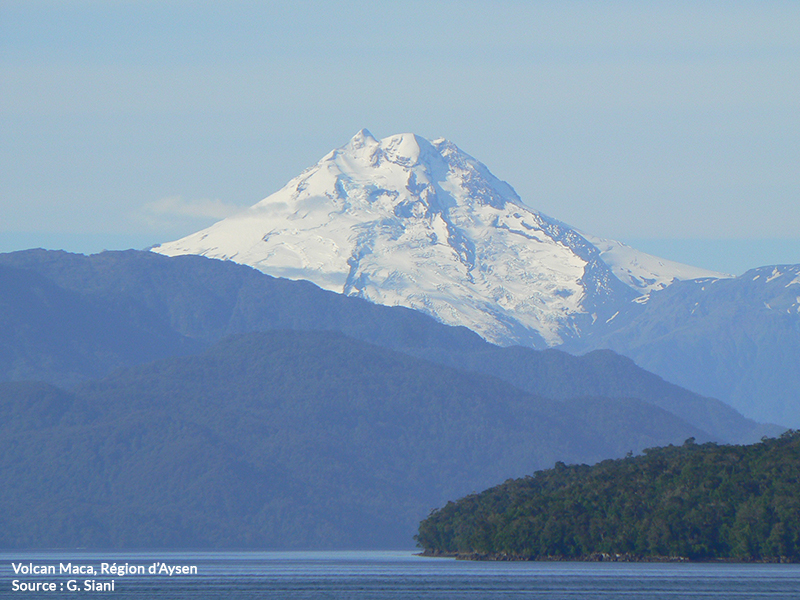
L. Beaufort (CEREGE), G. Siani (GEOPS), E. Michel (LSCE), N. Durand (LMC14), et C. Kissel (LSCE).

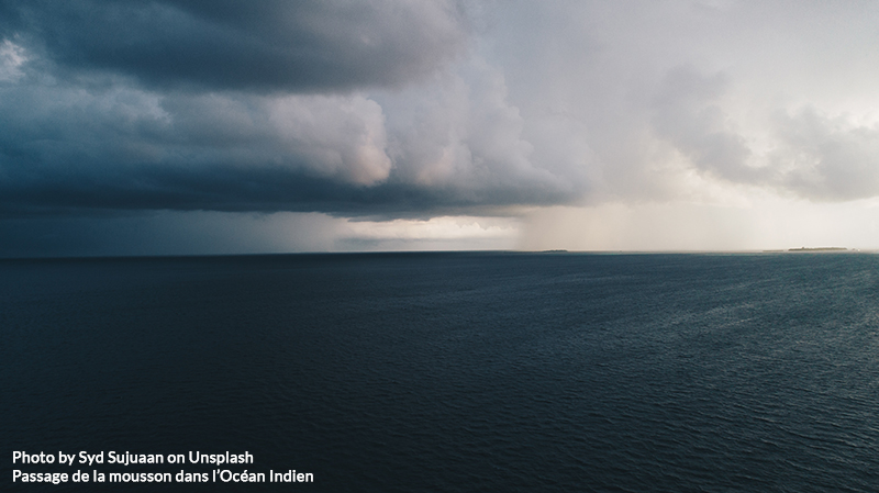
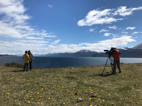
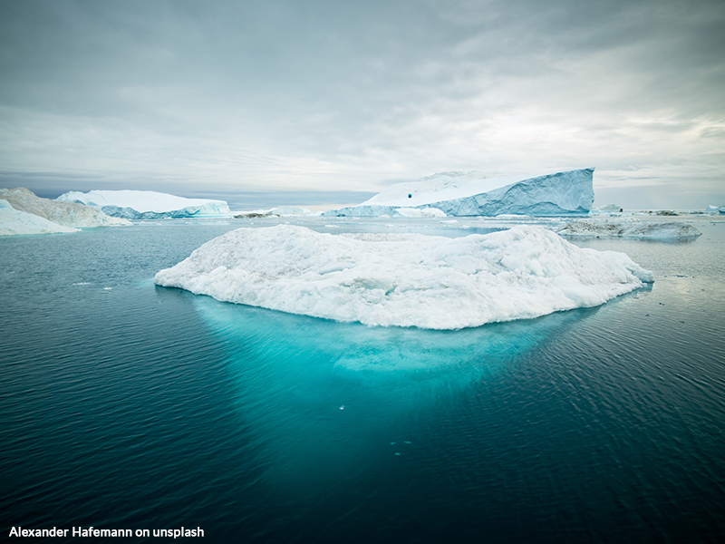
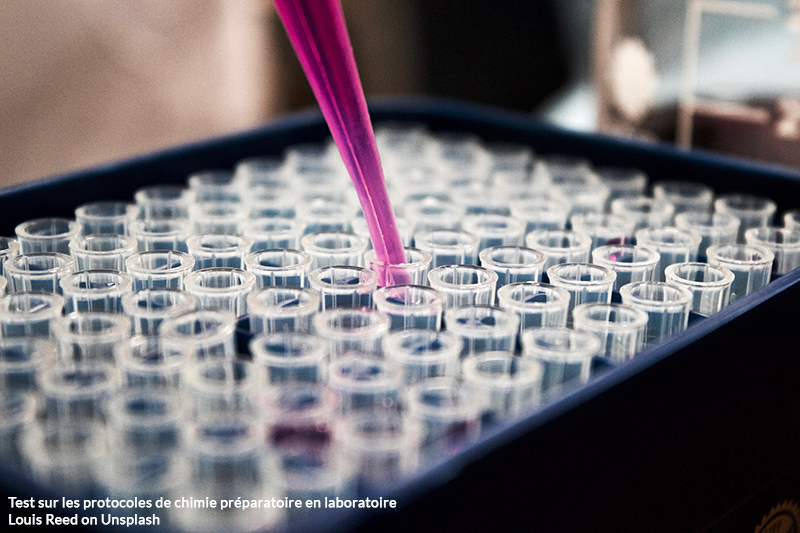
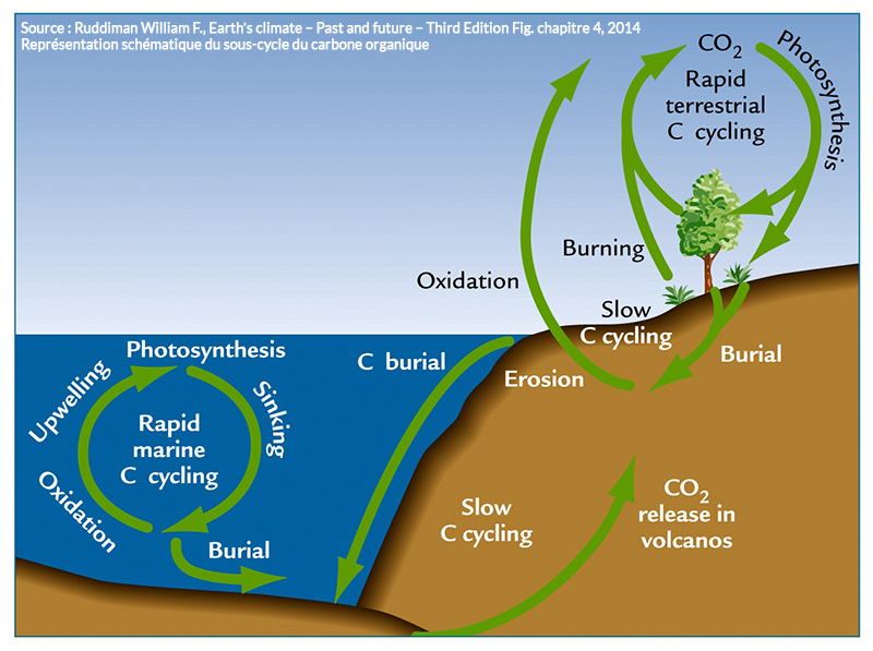
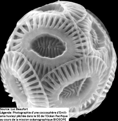
Measurements of CO2 trapped in Antarctic ice reveal that the pCO2 of the atmosphere during the Last Glacial Maximum (LGM) was 80 to 110 ppmv lower than the pCO2 value recorded for the interglacial period, before any anthropic activity. It turns out that significant changes in the position and intensity of oceanic fronts and of winds from the west (westerlies) in the high latitudes of the Southern Hemisphere, could on their own explain these major changes in atmospheric pCO2   by impacting on (i) the physical pump (ventilation of intermediate and deep ocean water masses); (ii) the effectiveness of the biological pump (variations in primary production); and (iii) ice coverage. In other words, these three mechanisms impact significantly on the amplitude of CO2 exchanges between the ocean reservoir and the atmospheric reservoir. The objective of this project is to better define the impact of the ocean-atmosphere system of the southern high latitudes on global levels of pCO2 in the Last Glaciation by simultaneously considering the physical and biological pumps. In particular, it aims to tackle the following issues: (i) the impact of the regime of westerly winds and oceanic fronts on the ventilation of intermediate and deep ocean water masses in the South Pacific Ocean (water stratification v upwelling); and (ii) the effectiveness of the biological pump (variations in primary production) since the LGM through the study of coccolithic assemblages (calcareous phytoplankton) and measurement of COT and CaCO3 contents of three sedimentary cores taken from Sub Antarctic zone of the Pacific sector. Through a thesis being prepared by Elisabeth Teca (2019-2022), this project is completed by the study of diatom assemblages (siliceous phytoplankton) from sedimentary cores MD07-3088 and MD07-3082.

projet chicoFigure : Map showing the geographical locations of cores studied in this project (MD07-3100, MD07-3088 and MD07-3082); the cores follow a latitudinal transect within the sub Antarctic zone of the Pacific sector and are likely to record the dynamic of oceanic fronts in the region since the Last Glacial Maximum.

Associated thesis

Elisabeth Teca

Circulation InTeRmédiaire dans l’Océan iNdien depuis le dernier maximum GLACiairE

Funding

INSU-LEFE-IMAGO 2017 (2017-2019)

Project leader

S. Sepulcre (GEOPS

Collaborations

C. Colin (GEOPS), R. Ma (GEOPS), F. Bassinot (LSCE), N. Tisnérat-Laborde (LSCE), L. Licari (CEREGE)

The objectives of this research project fall within a study on the role of ocean circulation in the modalities of heat and salt transfer between low and high latitudes during the glacial-interglacial terminations. In particular, we are interested in changes that occurred between the Last Glacial Maximum and the Holocene at intermediate depths within the Bay of Bengal. In fact, while the role of intermediate water masses in the processes of teleconnection involved in the terminations is increasingly being studied for the Atlantic, Pacific and Southern Oceans, it remains little studied in the case of the Indian Ocean despite the presence of globally significant water masses. In order to meet our objectives, we propose a combined study of benthic foraminifera assemblages, which are sensitive to geochemical variations in water masses and sediment (trophic level, oxygen concentration), and geochemical tracers for a key period of the Earth’s climate history, Termination I: 1) Oxygen  (δ18O) and Carbon (δ13C) isotopic composition; 2) element ratios measured in tests of benthic foraminifera (Cd/Ca, Mg/Ca, B/Ca, Sr/Ca et U/Ca); 3) Δ14C (the difference between the C14 of planktonic and benthic  foraminifera); 4) εNd. These different complementary records, which are unprecedented for the study zone, allow us to accurately characterize variations in circulation at intermediate depths in the Bay of Bengal. These measurements will be compared to changes occurring at the surface and at depth both at the study site and at the scale of the Indian Ocean; ultimately, this will allow us to integrate these variations at a global scale. We will thus improve our understanding of the role of intermediate water masses during Termination I and the teleconnections between high latitudes and low latitudes.

projet citron-glace

Reconstruction of the extension of Antarctic Intermediate Waters a) at present and b) during the Last Deglaciation and its relationships to ventilation in the Southern Ocean and to CO2 degassing (Yu et al., EPSL, 2018.)

Associated thesis

Riufang Ma

ECOS Sud CONICYT Chili

Project leader

G. Siani (GEOPS) and Ricardo De Pol Holz (Centro de Investigación GAIA-Antárctica (CIGA) and Center for Climate and Resilience Research Universidad de Magallanes)

Other participants

S. Duchamp-Alphonse (GEOPS), E. Michel (LSCE), C. Kissel (LSCE), C. Latorre Hidalgo (Pontificia Universidad Católica de Chile).

Project / Programme

The impact of circulation changes and the melting of the Patagonian ice sheets on the regulation of atmospheric CO2 by the Southern Ocean.

This project is based on very close cooperation between three teams from the Nucleo Milenio Paleoclima Hemisferio Sur (NMPHS) at the Universidad de Magallenes and the Universidad Católica de Chile in Chile, and the GEOPS and LSCE labs in France.

Objectives

The Southern Ocean (SO) and its circulation play a fundamental role in the global climate system. In fact, a key element of thermohaline circulation is the return route of water masses from the deep ocean to the surface via the dynamic of upwelling. This return route is in part controlled by latitudinal position and the intensity of westerly winds. In recent years, the study of the Southern Ocean and its upwellings has become a priority for a better understanding of the climate system since they control the quantities of heat and carbon transferred from the deepest ocean reservoir to the surface ocean and the atmosphere.

Beagle Channel(Isla Navarino)

Up until now, most studies have considered either the role played by the physical pump, or that played by the biological pump, to explain this transfer of carbon from the ocean to the atmosphere. However, the increase in upwelling in the Southern Ocean over the last glacial transition has led to an increase in exported biological production. It is, therefore, desirable to study the interactions between the two CO2 pumps by looking at high resolution climatic records sampled in key areas of the Southern ocean. The western part of South America and the adjacent South-East Pacific, are unique regions for answering key questions regarding the evolution of the world’s climate due to their transitional position between subtropical and subarctic climate regimes. This study region features important interactions between the various components of the climate system: large scale atmospheric circulation, Southern Ocean circulation, and CO2 exchange between the atmosphere and the ocean.


Beagle Channel (Isla Navarino)


Within the framework of the ECOS Sud-CONICYT cooperative programme, we propose a multi-tracer study of marine sedimentary cores from the South-East Pacific sector of the Southern Ocean. The last Glaciation and the transition to the Holocene are the most promising climate periods for studying the evolution of biological and physical CO2 pumps because they are characterized by major changes in global-scale ocean circulation. In particular, we aim to gain a better understanding of the impacts of the melting of the Patagonian ice sheets and ocean circulation on the regulation of atmospheric CO2 by the Southern Ocean. In addition, the high sedimentation rates of our climate archives will allow us to obtain high quality data with very robust temporal control.

Associated thesis

Margaux Brandon

Holocene North Atlantic Gyres and Mediterranean Overturning dynamic through Climate Changes

Funding

ANR (2013-2018)

Project leader

C. Colin

Partner Laboratories

GEOPS (Univ. Paris Saclay, campus Paris Sud Orsay)
Laboratoire des Sciences du Climat et de l’Environnement (LSCE/IPSL, CEA-CNRS-UVSQ)
EPOC-CNRS, Université de Bordeaux
CEREGE (CNRS-Univ. Aix-Marseille)
LPGNantes (Université de Nantes)
M2C (Université de Rouen)

Context

The North Atlantic plays a fundamental role in the European climate through its system of meridional ocean circulation, known as Atlantic Meridional Overturning Circulation (AMOC) the dynamics of which control the salt and heat budgets of the North Atlantic. The intensity of the sub-polar gyre, which is in turn principally governed by atmospheric dynamics and flows of fresh water, today controls the northern limit of the intrusion of salty Mediterranean waters and the flows of sub-tropical Atlantic water reaching northern latitudes. Its dynamics also have a primary impact on the climate of Northern Europe. In this context, changes in the thermohaline circulation of the Mediterranean over the course of sapropel deposition events and exchanges of water masses between the eastern and western basins, on the one hand, and between the North Atlantic and the Mediterranean, on the other, still remain relatively unexplored and poorly quantified. Furthermore, the impact of hydrological changes occurring on the European edge of the Mediterranean is poorly constrained even though these Mediterranean waters can have an impact on the salt budgets and on the formation of deep water in the North Atlantic.


Objectives

Our research aims to improve our knowledge of the hydrology of the Mediterranean and its European margin with a view to reconstructing the AMOC and thermohaline circulation in the Mediterranean during sapropel deposition events; we also aim to identify the impact that Mediterranean thermohaline circulation might have on circulation in the North Atlantic.

Associated missions

Mingulay-Rockall, Ice-CTD

Find out more …

Associated thesis

Maxence Duhamel

MAGnesium thermometer Improvement for assessing Climate Sensitivity

Funding

INSU-LEFE-IMAGO 2016 (2016-2018)

Project leader

F. Bassinot (LSCE)

Collaborations

S. Sepulcre (GEOPS), X. Pang (LSCE/GEOPS), H. Dang (LSCE), D. Blamart (LSCE), T. de Garidel-Thoron (CEREGE)

One of the principal approaches used to gain a better understanding of climatic sensitivity involves comparing past changes in ocean temperature with variations in greenhouse gases (GHG) recorded in ice. This type of approach requires the compilation of a database of paleotemperature information covering key periods (e.g. the Last Glacial Maximum LGM) for which we have GHG data retrieved from ice cores. But recent compilation efforts have revealed a number of challenges: (i) the difficulty involved in combining estimations from different tracers, and (ii) a certain number of problems specific to each tracer. This is the case for ocean temperatures reconstructed on the basis of Mg/Ca ratios in foraminifera where three principal problems are encountered:

(i) Uncertainty regarding the taxonomy used by geochemists;

(ii) Heterogeneity of sample preparation protocols used combined with differences in the choice of calibrations;

(iii) The absence of a common strategy concerning the taking into account (or not) of salinity as a factor that might potentially affect the Mg/Ca signal.

In order the better constrain these difficulties, the MAGICS project adopts a three-pronged approach:

  1. The development of a strategy which allows the integration of Mg/Ca data from various labs (i.e. obtained using different analysis protocols) and the application of a temperature conversion which is as robust and coherent as possible;
  2. The creation of a new dataset, subject to taxonomic controls, which will allow us to draw conclusions regarding the potential impact of salinity on the Mg/Ca thermometer and to propose a method of correction;
  3. The more precise reconstruction of differences in ocean surface temperatures between the LGM and the present, with a particular focus on the intertropical band and the Pacific Warm Pool of the western pacific, and the use of this data to fine tune estimations of climatic sensitivity.

Projet magics

Map of ocean surface temperatures showing the connection between the Pacific and Indian Oceans and the extent of the present-day Warm Pool (Temperatures greater than 28°C).

Associated thesis

X. Pang

South-Est Pacific Ocean Reservoir Age – Quantification of C14 ages for the South-East Pacific ocean reservoir

Funding

INSU-LEFE-IMAGO 2016 (2016-2018)

Project leader

G. Siani (GEOPS)

Collaborations

G. Delpech (GEOPS), S. Duchamp-Alphonse (GEOPS), E. Michel (LSCE)

Project / Programme

Action “Interactions Multiples dans l’Atmosphère, la Glace et l’Océan” (IMAGO) [Multiple Interactions in the Atmospheres, Ice and Ocean]

The Southern Ocean (SO) plays a fundamental role in the global climatic system. In fact, a key element in thermohaline circulation is the return route of water masses from the ocean depths to the surface via upwelling. This process is largely controlled by latitudinal position and the intensity of winds from the west (westerlies).  In recent years the study of the SO and these upwelling has become a priority in order to obtain a better understanding of the climatic system because, in particular, they control the quantity of heat and carbon transferred from the deepest ocean reservoir to the surface ocean and the atmosphere. The development of accurate age models for the marine and continental archives is therefore essential for better understanding the mechanisms, the temporal frequency, and the geographical repercussions which govern ocean-climate interactions. An essential prerequisite for establishing robust age models in the marine context, is the quantification of C14 ages for the surface ocean reservoir (Rsurf) which is principally linked to the reduction of C14 in the water column and to the mixing of different water masses, in other words ocean circulation. Regional stratigraphic markers, such as volcanic tephras retrieved from marine cores and terrestrial archives, are used to reconstruct past (Rsurf). The project’s scientific goal depends on the detailed study of the marine and continental tephrachronology using sedimentary series sampled along a N-S transect off the southern coast of Chile (Figure 1; 40°S and 46°S). Using laser ablation in conjunction with LA-ICP-MS-HR analysis allows more accurate identification of the volcanic sources and thus ensures that robust correlations are made between marine and continental tephras. This allows an independent estimation of Rsurf variations and makes it easier to establish accurate age models of marine climatic records on the South-East Pacific rim. This data is necessary in order to constrain: (i) the ventilation time of intermediate and deep ocean water ventilation and the depth at which the upwelling cell ascends within the SO; (ii) the climatic mechanisms controlling ocean circulation in this region and, at a larger scale, the carbon cycle since the last glacial period.

This project is being undertaken within the framework of a PhD thesis by Consuelo Martinez Fontaine (Estimation of C14 ages of the surface and deep ocean reservoir in the South-eastern Pacific sector of the Southern Ocean since the last glacial period)

Projet SEPORAFigure 1: Map of South America and the South-eastern Pacific Ocean representing: white arrows, the principal ocean currents (ACC: Arctic Circumpolar Current; CHC: Cape Horn Current; PCC: Peru-Chile Current; AAIW: Antarctic Intermediate Waters; CPDW: Pacific Deep Water); red arrows, the westerly winds; SVZ: South Volcanic Zone; AVZ: Austral Volcanic Zone. The locations of terrestrial sites are indicated by white dots. Marine core sites are indicated by yellow stars apart from reference core MD07-3088 (4, red dot). Also included is a salinity/latitude/depth section representing the positions of the cores as a function of their bathymetry and the main ocean water masses.

Associated thesis

Consuelo Martinez Fontaine

The post-glacial evolution of Lake Urmia (Iran) : current context and paleoenvironmental reconstructions for a better understanding of natural and anthropic impacts

Funding

INSU-TelluS-SYSTER 2019

Project leader

A. Tudryn (GEOPS)

Collaborations

E. Gibert-Brunet (GEOPS), P. Tucholka (GEOPS), A. Noret (GEOPS), S. Miska (GEOPS), M. Massault (GEOPS), O. Dufaure (GEOPS), M. Djamali (IMBE), H. Motavallianbaran (Univ de Téhéran), M. Lankarani (Univ. Téhéran), H. Ahmady-Birgani (Univ. Urmia), H. Lahijani (INIOAS, Téhéran), A. Sharifi (INIOAS), M. Shah-Hosseini (INIOAS).

projet Epure

Lake Urmia is one of the largest salt-water lakes in the world. Since the1980s it has suffered severe environmental damage that has seen its level drop by 7 m over the past 15 years. Still the subject of controversy, this drop in water level has variously been attributed to a 10% drop in precipitation and to anthropic causes (the construction of several dams on rivers that feed into the lake, over-pumping of subterranean water, etc.). However, despite the clear over-exploitation of water, the respective impacts of natural and anthropic factors on the lake’s watershed have still not been quantified.

The principal objective of this project is to decipher the trends in the environmental evolution of the lake since the Last Glacial Maximum and to identify the natural and anthropic changes that have occurred over the course of the Holocene. Our approach is based on analyses of lacustrine sediments and of the waters of the lake and aquifers. The results (1) will be used  to formulate sustainable management plans for water sources and ecology on a regional scale, and (2) will be integrated within supra-regional (Western Iran, and Anatolia are situated within the zone of influence of the Eastern Mediterranean and act as a link between Europe, North Africa and Northern Asia) and global scale climate studies in order to accurately correlate climatic variations with other terrestrial and marine records.

These objectives will be achieved by means of three main steps:

  • The establishment of a hydrological reference system for the lake, which encodes all current aspects such as water testing and hydrogeochemical characterization for each fluctuation;
  • The reconstruction, at a high temporal resolution (certified chronology), of Late Quaternary environmental changes in the lake zone by verifying sedimentological, hydrochemical and biological indicators/markers;

The identification of past human and natural (climate, seismic activity) impacts on the hydroenvironments of the lake and its watershed

REconstructing the influence of Climate change on lAterite formation

Funding

ANR 2017 (2018-2021)

Project leader

C. Gautheron (GEOPS)

Collaborations

S. Sepulcre (GEOPS), F. Haurine, C. Quantin (GEOPS), D. Calmels (GEOPS), R. Pinna-Jamme (GEOPS), G. Monvoisin (GEOPS), J. Nouet (GEOPS), J. Roques (IPN), T. Allard (IMPMC), G. Morin (IMPMC), E. Balan (IMPMC), M. Guillaumet (IMPMC), J. Bouchez (IPGP), C. Rollion-Bard (IPGP), P. Agrignier (IPGP), Z. Fekiacova (CEREGE), I. Basile-Doelsch (CEREGE), A. Guihou (CEREGE), B. Angeletti (CEREGE), J.-Y. Roig (BRGM), G. Aertgeerts (BRGM), M. Dall’Asta (TOTAL), J.-P. Girard (TOTAL), J. Braun (GFZ, Germany), A. Horbe (IG, Brazil), G. Bueno (LABOGEF, Brazil), L. Cherem (LABOGEF, Brazil)

Laterites are deep weathering covers of the critical zone that occupy 80% of the total soil-mantle volume of the Earth’s landscape and significantly contribute to the global geochemical budget of weathering and erosion, and greenhouse gas consumption. Despite their factual importance on Earth surface, the timing of their formation and their evolution in response to climatic and geodynamic forcing are still not fully understood. The originality of the RECA project is to combine chronometric, weathering and climatic proxies developed in the recent years in order to build a comprehensive and predictive scenario of laterite formation and evolution. We will concentrate our effort on geodynamically stable Guyana Shield and Central Amazonia regions, where laterites formed through the whole Cenozoic and can be associated with major geomorphological units. This ambitious multidisciplinary project proposes, for the first time, to perform absolute dating of lateritic duricrusts associated to five episodes of planation in the South American subcontinent. We will date mineralogically well-identified populations of iron oxides and oxyhydroxides (hematite, goethite) and clays (kaolinites) by using (U-Th)/He, (U-Th)/Ne and electron paramagnetic resonance spectroscopy, respectively. The inherent complexity of weathering materials, which may contain different populations of a same secondary mineral related to distinct stages of lateritization will be taken into account. The timing of duricrust formation will then be related to paleoclimatic conditions (temperature, rainfall) derived from a combination of geochemical or mineralogical indices and proxies: (i) at global scale, through, for example, the known continental drainage curves; (ii) at a more regional scale through the intensity of weathering, the ratio hematite/goethite or O and H isotope systems of kaolinite and iron oxides and oxyhydroxides. We will also associate non-conventional Li, Si and Fe isotopic methods that will help to decipher the evolution of weathering processes linked to the various stages of laterite formation. Coupling weathering budget and the ages of weathering profiles will yield average weathering and erosion rates, allowing comparison with other weathering environments or paleo-environments at the Earth surface.

Projet RECA

Interactions between the various processes (climat, global geodynamics) operating at several timescales on the evolution of lateritic surfaces of the Amazonian shield, the establishment of which is estimated by various geochronometers and geochemical tracers (Ar/Ar dating, 36Cl) Yu et al., Elements, 2015.

PALeoventilation MEDiterranean Sea – Tracing and paleoventilation of intermediate and deep water masses in the Mediterranean since the last glacial period.

Funding

INSU-LEFE-IMAGO 2019 (2019-2021)

Project leader

C. Colin (GEOPS)

Collaborations

C. Colin (GEOPS), G. Siani (GEOPS), M. Duhamel (GEOPS), S. Zouari (GEOPS/GEOGLOB – Univ. Sfax) N. Tisnerat-Laborde (LSCE), F. Thil (LSCE), Dapoigny (LSCE), M. Revel (Géoazur, Nice), K. Tachikawa (CEREGE, Aix-Marseille), S. Toucanne (IFREMER, Brest), E. Ducassou (EPOC, Bordeaux), M. Paterne (LSCE, Gif-Sur-Yvette), N. Kallel (GEOPS/GEOGLOB – Univ. Sfax).

This project aims to test the various hydrological scenarios that have led to changes in the thermohaline circulation in the Mediterranean over the last glacial period and last deglaciation. The object is to better constrain the mechanisms that underlie these hydrological changes which occurred during rapid climatic events of the last glacial period and their potential impacts on the deposition of organic-rich deposits (i.e. ORL, sapropels). In order to do this, we propose to reconstruct the hydrological variations of the intermediate and deep water masses in the central Mediterranean (the Ionian Sea, the Straits of Sicily, the western Mediterranean around the Sardinian Channel and Corsica). We use the difference in C14 ages between deep and intermediate waters and the surface in order to identify changes in the ventilation of intermediary and deep water masses. These analyses are carried out using a new generation of accelerator mass spectrometers, the ECHoMICADAS, which allows us to use carbon 14 to date samples containing as little as 20 µg of carbon. These results are then combined with the trace evidence for the origin of the water masses based on the isotopic composition of the Nd in planktonic foraminifera (for the period post 30 ka). Analyses of foraminifera Nd and benthic foraminifera δ13C will also be carried out for sapropel S3 (beyond the scale of C-14 dating) in order to constrain the hydrology that gave rise to this anoxic event which occurred under glacial environmental conditions (sea level, inputs of fresh water from the African continent and the hydrological connection at the Straits of Gibraltar) that differ from the environmental conditions prevailing at the time when sapropel S1 was deposited.

.


Projet palmeds

General outline of the hydrology of intermediate water masses in the Mediterranean and the locations of cores selected for the PALMEDS project.


Associated thesis

Maxence Duhamel, Sounda Zouari

BIOlogical Productivity changes and their leverage on the Carbon and Oxygen cycles during the last Deglaciations

Funding

INSU-LEFE-IMAGO 2019 (2019-2022)

Project leader

S. Duchamp-Alphonse (GEOPS) and A. Landais (LSCE)

Collaborations

M. Brandon (GEOPS/LSCE), M. Kageyama (LSCE), L. Bopp (LMD), E. Michel (LSCE), D. Roche (LSCE), G. Siani (GEOPS), F. Prié (LSCE), T. Extier (LSCE), T. Blunier (Université de Copenhague) et F. Manssouri (LSCE).

Since the 1950s, increasing CO2 emissions have amplified the natural greenhouse effect of the Earth, which is evident in a decrease in ice cover, a rise in sea level and the recurrence of extreme meteorological and climatic events, all of which have considerable consequences for natural and human systems. The important roles played by ocean circulation (particularly in the Southern Ocean) and biospheric productivity in variations of atmospheric pCO2 have been clearly identified. However, the processes that led to these variations and the impacts on the ecosystem since the industrial revolution, and also in pre-anthropic contexts, remain poorly understood. This fact limits our understanding of the climatic system of the future.
More particularly, over the past 800 ka, while an important part of the increases of atmospheric pCO2 recorded during the deglaciations can be attributed to the reinvigoration of austral upwelling which favours the degassing of CO2 from the deep ocean reservoir to the atmosphere, the scale of the changes in pCO2 is also a function of biological productivity, the past dynamics of which are still poorly understood.
The aim of this project is to more accurately quantify the changes in biological productivity and their impacts on the carbon- (C) and oxygen (O) cycles during the Quaternary deglaciations, by combining the expertise of several laboratories in the Isle de France (GEOPS, LSCE, LMD) in order to couple new, complementary empirical approaches with global climate modelling experiments. Specifically, measurements of the ∆17O composition of the EDC core, retrieved from the Antarctic, will allow us to quantify global photosynthetic oxygen for the past 800 ka. The calibration of the BrXRF/CaXRF signal of a Southern Ocean sedimentary core in terms of exported COT/CaCO3, through a micropaleontological and geochemical approach, will allow us to quantify changes in the efficiency of the biological pump in a key region for CO2 exchanges between the ocean and the atmosphere over this time period. The use of the outputs from oceanic bio-geochemistry and vegetation models will facilitate comparisons of the empirical results.

projet biocod