The post-glacial evolution of Lake Urmia (Iran) : current context and paleoenvironmental reconstructions for a better understanding of natural and anthropic impacts
Funding
INSU-TelluS-SYSTER 2019
Project leader
A. Tudryn (GEOPS)
Collaborations
E. Gibert-Brunet (GEOPS), P. Tucholka (GEOPS), A. Noret (GEOPS), S. Miska (GEOPS), M. Massault (GEOPS), O. Dufaure (GEOPS), M. Djamali (IMBE), H. Motavallianbaran (Univ de Téhéran), M. Lankarani (Univ. Téhéran), H. Ahmady-Birgani (Univ. Urmia), H. Lahijani (INIOAS, Téhéran), A. Sharifi (INIOAS), M. Shah-Hosseini (INIOAS).

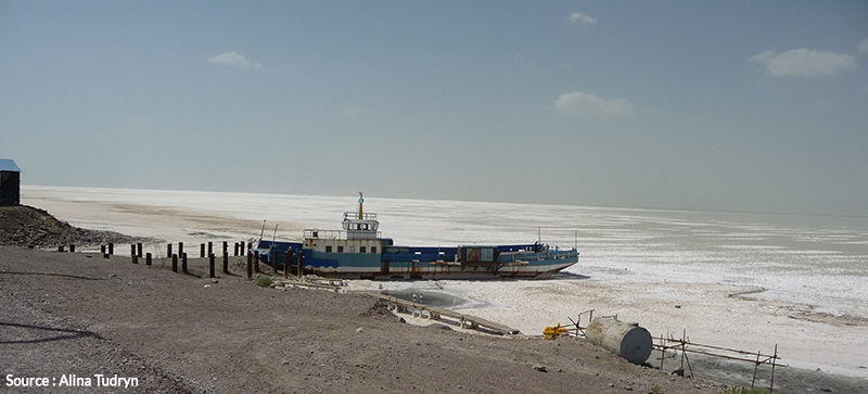
Lake Urmia is one of the largest salt-water lakes in the world. Since the1980s it has suffered severe environmental damage that has seen its level drop by 7 m over the past 15 years. Still the subject of controversy, this drop in water level has variously been attributed to a 10% drop in precipitation and to anthropic causes (the construction of several dams on rivers that feed into the lake, over-pumping of subterranean water, etc.). However, despite the clear over-exploitation of water, the respective impacts of natural and anthropic factors on the lake’s watershed have still not been quantified.
The principal objective of this project is to decipher the trends in the environmental evolution of the lake since the Last Glacial Maximum and to identify the natural and anthropic changes that have occurred over the course of the Holocene. Our approach is based on analyses of lacustrine sediments and of the waters of the lake and aquifers. The results (1) will be used to formulate sustainable management plans for water sources and ecology on a regional scale, and (2) will be integrated within supra-regional (Western Iran, and Anatolia are situated within the zone of influence of the Eastern Mediterranean and act as a link between Europe, North Africa and Northern Asia) and global scale climate studies in order to accurately correlate climatic variations with other terrestrial and marine records.
These objectives will be achieved by means of three main steps:
- The establishment of a hydrological reference system for the lake, which encodes all current aspects such as water testing and hydrogeochemical characterization for each fluctuation;
- The reconstruction, at a high temporal resolution (certified chronology), of Late Quaternary environmental changes in the lake zone by verifying sedimentological, hydrochemical and biological indicators/markers;
The identification of past human and natural (climate, seismic activity) impacts on the hydroenvironments of the lake and its watershed